


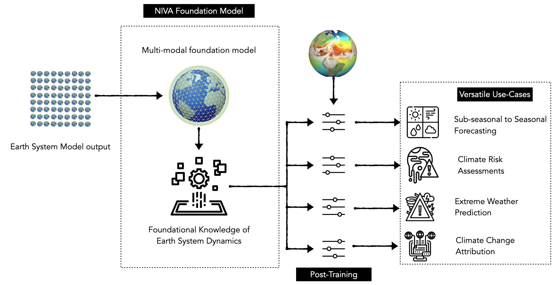
NIVA: A Multimodal Foundation Model for Actionable Earth System Intelligence
Preprint
I am a machine learning researcher and engineer with a Master’s in Computer Science from Georgia Tech, where I was supervised by Prof. Judy Hoffman on problems related to robustness and distribution shift in vision systems. I have also had the unique privilege of working across a range of interdisciplinary industry settings, spanning early-stage startups to large-scale organizations, including Planette AI, Corteva Agriscience, HyperVerge, and Microsoft.
Broadly, I am interested in understanding how domain-specific structure and expert knowledge can be leveraged to build robust and interpretable ML systems.
| June, 2025 | Presented Leveraging CESM2 data for machine learning based S2S forecasting at the CESM Workshop 2025 |
|---|---|
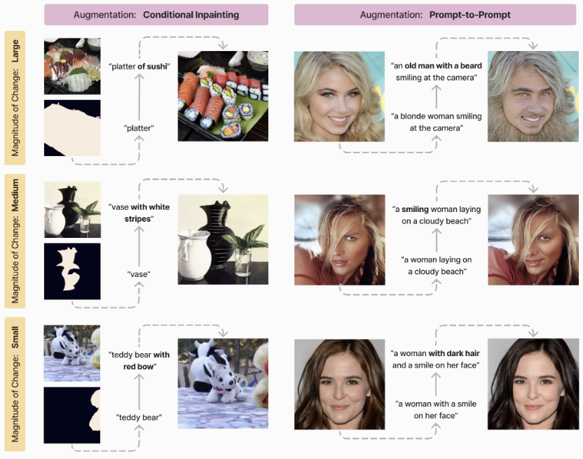
| Sep, 2024 | Semi-Truths: A Large-Scale Dataset of AI-Augmented Images for Evaluating Robustness of AI-Generated Image Detectors is accepted to NeurIPS 2024 Track Datasets and Benchmarks |
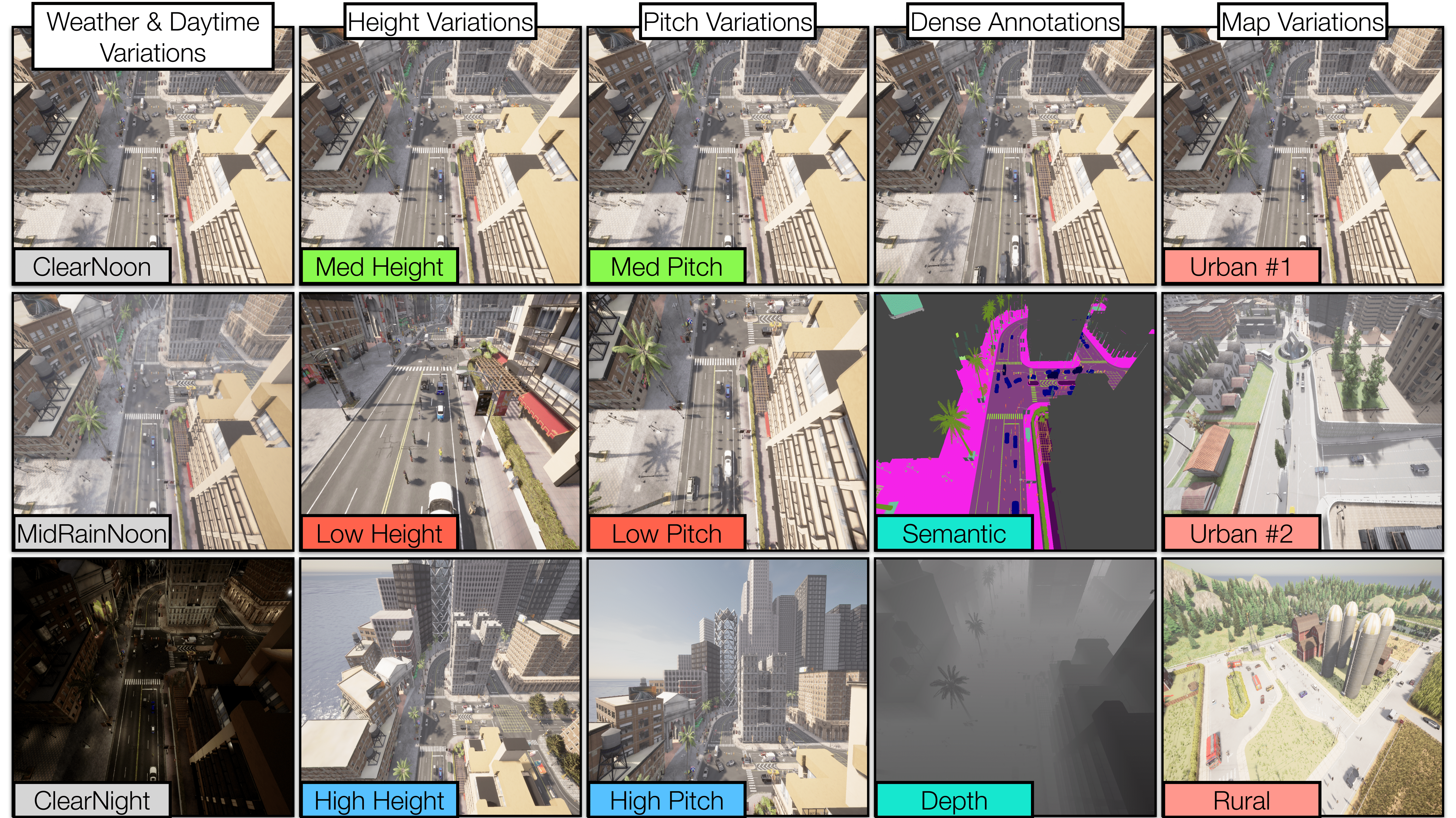
| July, 2024 | SkyScenes: A Synthetic Dataset for Aerial Scene Understanding is accepted to ECCV 2024 |
| May, 2024 | Joined as the Founding Machine Learning Engineer at Planette AI |
| May, 2023 | Interning at Corteva Agriscience this summer |
| August, 2022 | Joined the MS CS Program at Georgia Tech |
Preprint
NeurIPS, 2024
ECCV, 2024
IJMLC, 2019
ICVGIP, 2018